Common Mistakes When Reporting Local Wind Damage in Your Area
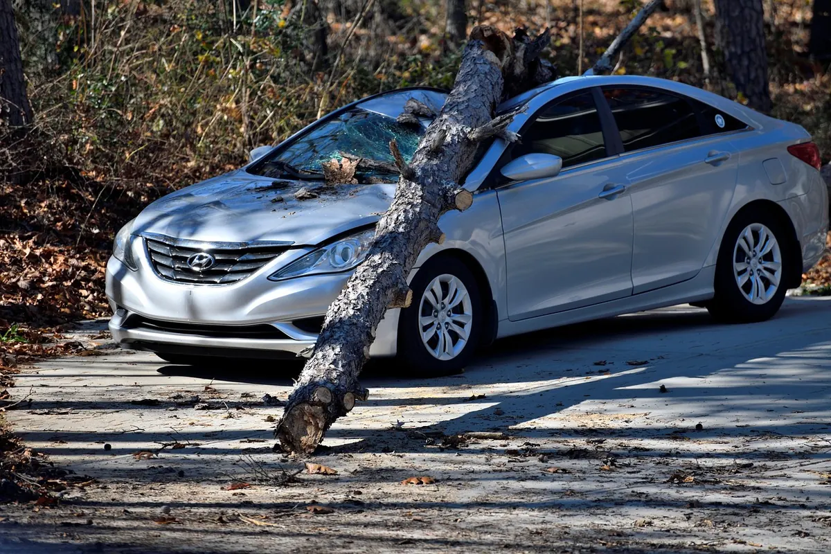
Every spell of rough weather brings a flurry of wind damage reports from residents, dog walkers and sharp-eyed amateur spotters. Most arrive with good intentions and one or two avoidable flaws. A fence panel down is useful. A fence panel down with no time, no direction and a wild guess at the wind speed is much less so — and it can quietly distort the picture of what actually happened in your area.
The good news is that nearly all of these mistakes take seconds to fix. Here is what tends to go wrong, and how to send a report that forecasters, councils and local news desks can genuinely use.
You describe the damage and forget the wind
When a tree comes down, the tree is the obvious thing to write about. But the tree only tells us what happened afterwards. What matters just as much is what the wind was doing at the time: which direction it was blowing from, whether it arrived in sudden violent bursts or blew hard for hours, and whether it shifted around.
Compare these two notes. “Strong wind all morning, big tree down in the park.” Or: “Calm until about 06.40, then one roaring burst from the west for maybe a minute, then it went quiet again, and the tree was down when I looked out at 06.45.” The second one tells a forecaster something specific about the character of the event. Even a rough version of it is better than nothing.
Add anything else you noticed: hail, thunder, torrential rain arriving at the same moment, a sudden drop in temperature. These details help build a picture of a squall line or a convective gust rather than a broad, steady blow.
You guess the wind speed instead of describing the effects
“It must have been a hundred miles an hour” is the single most common line in amateur reports, and it is almost always too high. Damage that looks dramatic is often caused by gusts well below that. Overstated speeds make an otherwise solid report easy to dismiss, so describe what you saw instead and let others do the converting.
The Beaufort scale is a useful shorthand, and the descriptions are the part worth remembering:
- Force 5–6: small trees in leaf begin to sway, then large branches are in motion, wires whistle and umbrellas become hard work.
- Force 7–8: whole trees in motion, walking into the wind is difficult, twigs snap off and slates or tiles start to lift.
- Force 9–10: structural damage becomes likely, larger branches break, and trees can be uprooted.
Say plainly that it is an estimate, and say where you were standing when you judged it. A gust felt in a sheltered back garden tells a different story from one measured in an open field.
The timing goes missing
“Sometime overnight” is almost impossible to work with. Gusts are short-lived, and a single violent minute can fell a tree while the rest of the night is unremarkable. A rough window is far better than nothing: “between three and four in the morning” beats “during the night” comfortably, and “between 05.15 and 05.30” is better still. If you were woken by a bang, a rattle or the bins going over, note that. It anchors the event to a clock time.
One gust, or a long blow?
These are different events with different causes. A single brief spike suggests a squall, a gust front or a tornadic feature; hours of relentless wind points to a passing deep low. If you can tell the difference, say so. If you cannot, describe the sequence and leave the interpretation to someone else.
The location is too vague
“The park” and “our road” mean very little to anyone outside your postcode. Give the street or nearest landmark, the town or village, and the postcode area. Then add the bit most people leave out: exposure. Was the damaged tree on an exposed ridge, a hilltop, a coastal frontage, or tucked into a sheltered valley? Wind damage clusters in particular places, and knowing the terrain around your report helps explain why one street lost three fences while the next one lost nothing.
Photos that prove nothing
A dark, blurred shot of a hedge taken from a moving car does not add much. A quick, deliberate set of images does.
- Take one wide shot that shows the surroundings, so the scene can be placed.
- Take one closer shot with something for scale, but keep your distance from anything leaning, cracked or hanging.
- Keep the original file, complete with its timestamp and location data. Screenshots and heavy edits strip that away.
- Skip the filters. Colour grading makes an image look staged, even when it is not.
A safety note: never approach downed power lines, damaged substations, or structures that look unstable. Report those to the relevant network operator or emergency service first, and photograph only from a safe distance.
You blame the wind for everything
Not every fallen tree is a wind story. Saturated ground, root disease, earlier groundwork, snow or ice loading, and vehicle strikes all bring trees down, sometimes on a moderately breezy day. Wind-borne debris causing damage is also different from direct wind pressure on a structure. Describe what you can actually see — exposed roots, a clean snap, rot in the stump, a fresh gouge in the bark — and keep your conclusion modest.
Resist the urge to declare a tornado, a microburst or a record gust. Those calls belong to people with instruments, radar and training. Your job is to record the evidence accurately, and a well-evidenced report often helps confirm exactly that kind of conclusion later.
A two-minute check before you hit send
Run through this list and your report will stand out for the right reasons:
- Time window, as tight as you can honestly make it.
- Location, with a street, landmark or postcode area.
- Wind behaviour: direction, gusts or steady, changes during the event.
- Effects described in plain language rather than guessed speeds.
- What was damaged, and anything you noticed about its condition beforehand.
- One wide photo and one with scale, original files intact.
- Your name and a way to contact you, in case someone needs to check a detail.
Send it promptly, and send it to somewhere that collects this sort of thing, whether that is your local weather watchers group, the local paper, your council or the national weather service’s reporting channels. Reports that arrive the same day, with times and places attached, are the ones that end up shaping the record. Yours can be one of them.
Photo: paulbr75 / Pixabay